 So I’m sure that most of you are familiar with the New Testament story of Jesus’ first miracle were he turns water into wine for a wedding party. The Bible tells us that this story took place in a city known as Cana. There are actually two different Canas within Galilee, each a possible site for the setting of the story depicted in the Bible. Cana (Qana) of Galilee was the site chosen by pilgrims to represent the story, and today it is a large city with gift shops at every corner; a Myrtle Beach of Galilee, as we often refer to it. The only problem is that the pilgrims of the crusades often gave Biblical locations actual sites in order to establish a place for worship, not basing their location on converging
  lines of evidence. This remains true with other sites; we do not know exactly where Jesus was baptized or where he was born, but these sites still exist in order to attract worshipers.
The other site is known as Khirbet Qana (the ruins of Cana), and it is where our dig is located. It is NOT our goal to prove that our Cana is the real site of the New Testament miracle. In fact, archaeology is never used to prove or disprove anything about the Bible; and of course I’m speaking of the proper use of archaeology by real archaeologist, not archaeological ‘pornography’ (as Byron calls it) found in the Discovery Channel’s “The Lost Tomb of Jesus” among many other misrepresentations. Rather, our goal is to just understand more about the cultures and civilizations that occupied the area known as Khirbet Qana. It might not be as exciting as discovering the Holy Grail while shooting our way through Nazis, but it will just have to do.
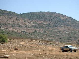
While Cana of Galilee is a modern city in itself, our site is completely secluded. It takes a twenty-five or thirty minute drive on rocky, dirt roads through farmland and up a steep hill,
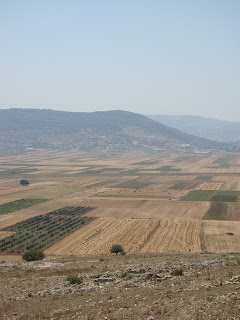
 also known as a Tel, to reach Khirbet Qana. A Tel is basically where civilization after civilization is stacked one on top of the other, eventually creating a hill. Our site is absolutely amazing and provides a view of beautiful mountains and a huge valley of farmland. It is obvious that a civilization existed on top of the hill as walls and other structures stick out of the ground. Pottery shards can be found everywhere on the site, and it is impossible to avoid them. They are distinguishable by their bright reddish clay color.
The team has split into three specific groups for three specific areas at the site. We usually get up at about 4:30 AM, leave for the site by five, break for breakfast at about 8:30, and work again until noon. My area that I am working on is a suspected reservoir. It is basically a large rectangular area with stone walls on each side. It is comparable to a large swimming pool, only it is filled with dirt and stones instead of water. Part of one of the stone walls has a layer of plaster which has been carbon dated to the Early Roman Period (around the first century CE). My site director, Termite, suspects that the reservoir has been
 through many reconstructions and might even date back to a Persian civilization; of course this is only speculation and not fact. We intend to reach the bottom which will be identified as a plastered stone floor and may be up to six meters or about twenty-five feet deep – that’s a lot of digging. By reaching the bottom of the reservoir, we will be able to calculate its total area, and therefore, the amount of water it could hold, and therefore, what type of population it had to support.
So far we have dug ten or fifteen centimeters and have found what is known as surface shards. Surface shards are just pottery shards that have stayed near the surface of the earth because of
 rain, while the heavier pieces stay buried. These pieces can’t tell us much, but we do know that they date as early as the Roman Periods. I especially like the shards that have a green glaze, typical of Arab pottery and probably from the twelfth or thirteenth century. We work in a square that is five by five meters, but we only dig in a four by four hole, leaving an extra meter to the north and the west side (called the baulk) which is used to view the stratigraphy. Stratigraphy is the study of the layers of the earth which help us date artifacts; for example, if a first century coin is found in a given layer of earth and a lamp is found in the same layer, then we know that the lamp is also from the first century. The other excavations consist of an opened and empty family tomb and an olive press and miqvah (ritual bath) dug into the hill, although I have my doubts that it is actually a grape press and a storage room. There is plenty more to come on our site later as more is uncovered.
No comments:
Post a Comment